Well, we didn’t immediately leave San Carlos. There were shakedown cruises to be taken, gear to be calibrated, provisions to procure, cargo to stow. And it turned out that the dinghy and its motor came out of summer storage a little the worse for it. Parts had to be sent away for. So we swung on anchor in the bay for a couple of weeks and The Captain had way too many margaritas on the bayfront.
A fellow named “Jose The Upholsterer” stopped by and asked whether I needed any sewing jobs done. So he ended up doing my dinghy chaps project that I hadn’t got around to. And ask we kept not leaving, he did a few more – adjusting the settee backs to make room for the air conditioner vents, making a cover for the generator. I was going to get around to those things, one of these days, but the dinghy was in dire need.
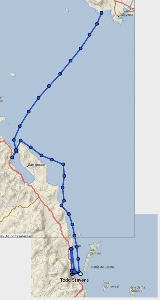
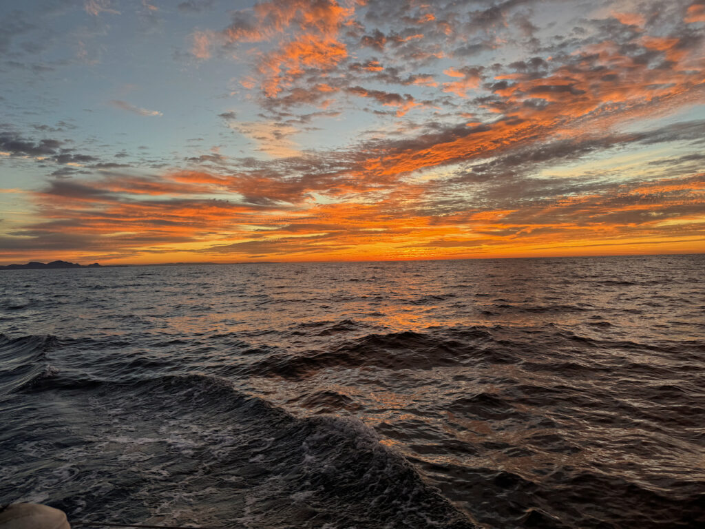
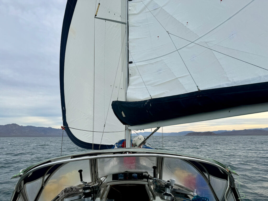
But finally, a few days after Thanksgiving, in the pitch-black pre-dawn, the anchor came up and we crept out of the bay on radar. There were pangas out there with no lights and nets in the water. Just about the time that the sun came up, so did the wind and we jetted off under the new sails, to cross the Sea of Cortez.
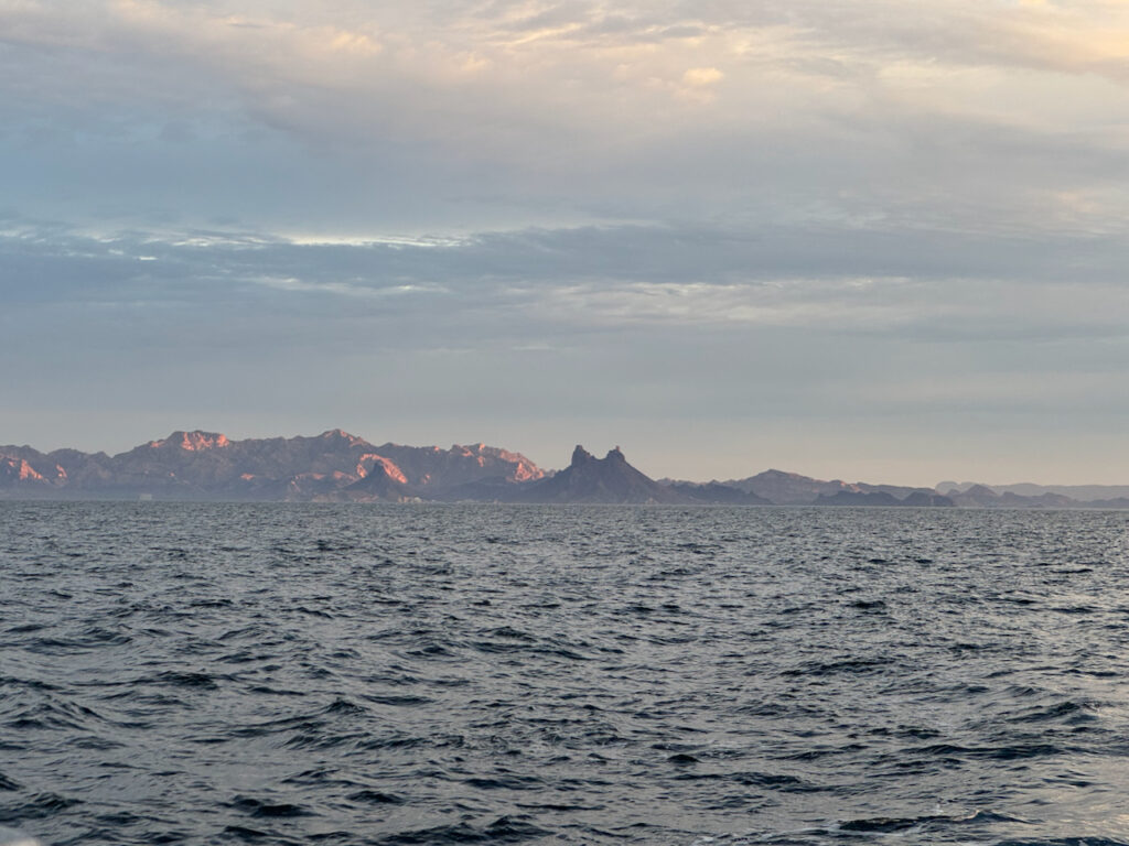
Cerro Tetakawi slowly receded behind us. On the charts, this formation is called “Tetas de Cabra,” for obvious reasons. But I guess the resort developers felt that it needed a more “family friendly” name. It guards the bay at San Carlos and fishermen can follow it home for many miles. Now they’re claiming that “Tetakawi” is an old indian name…
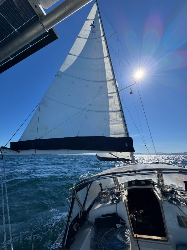
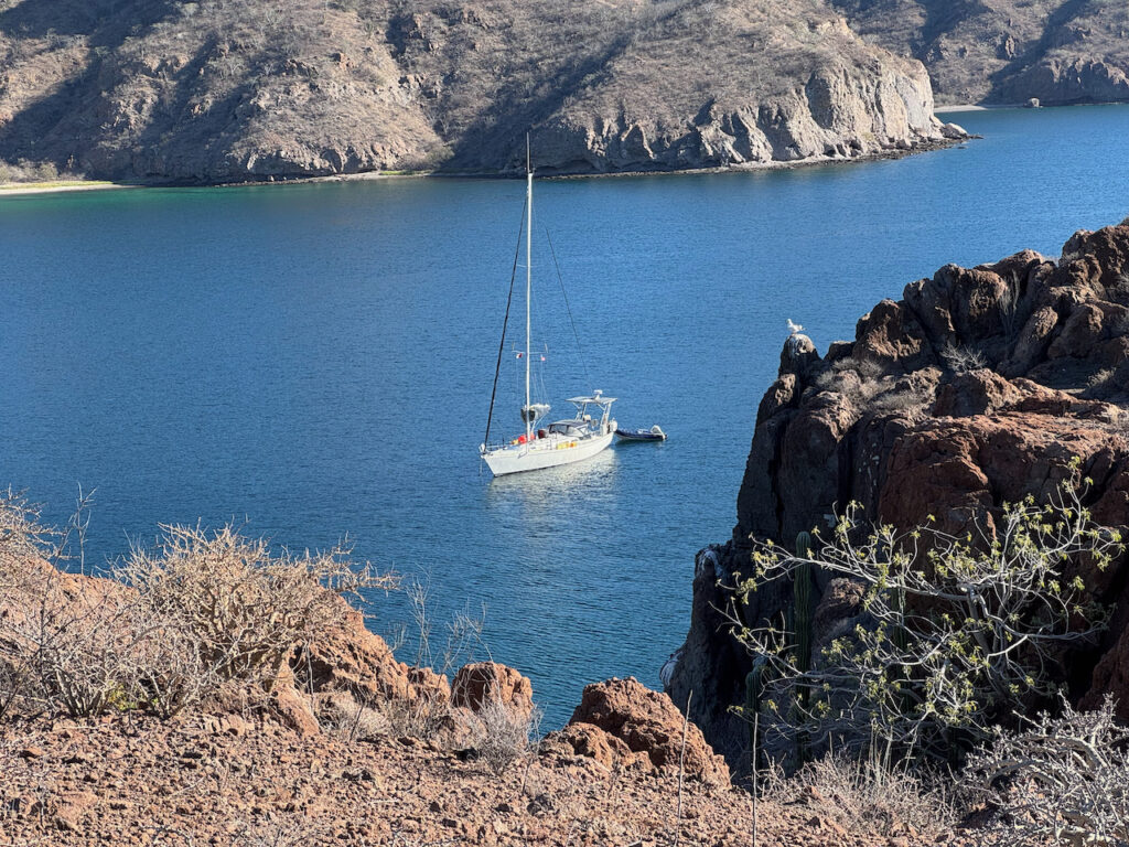
With a clean bottom and fresh new sails, the broad reach across the sea was exhilarating, if a little bouncy. We were often surfing along the fronts of the waves and speed over ground (SOG) was reaching 10-11 knots! The 85 miles from Sonora to Baja went by effortlessly. There was still plenty of daylight when we turned downwind and sailed wing-and-wing into Bahia Concepcion, the largest bay in the gulf. Then just before dark, reached into Bahia Coyote, dropped anchor off the Playa Santispac, and rolled into the bunk for a well-earned nap.
/
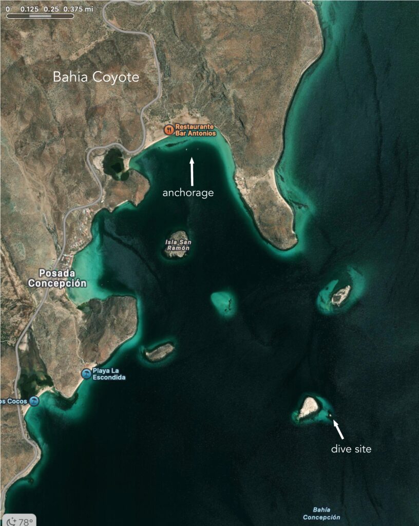
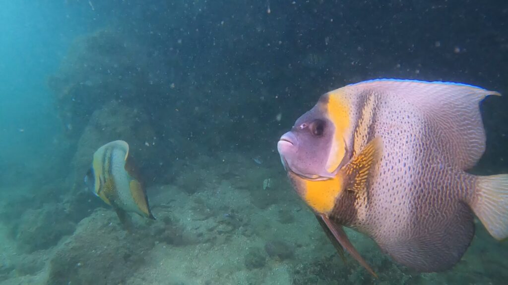
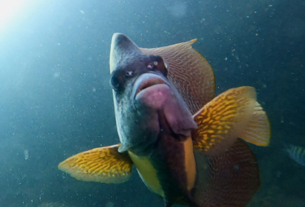
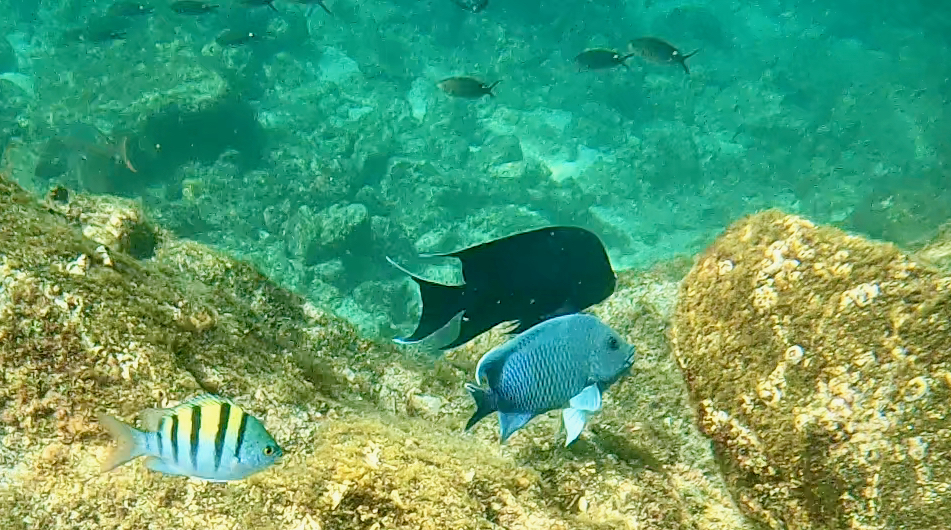
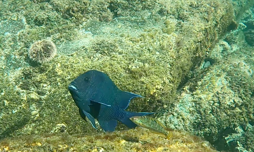
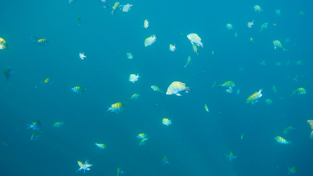
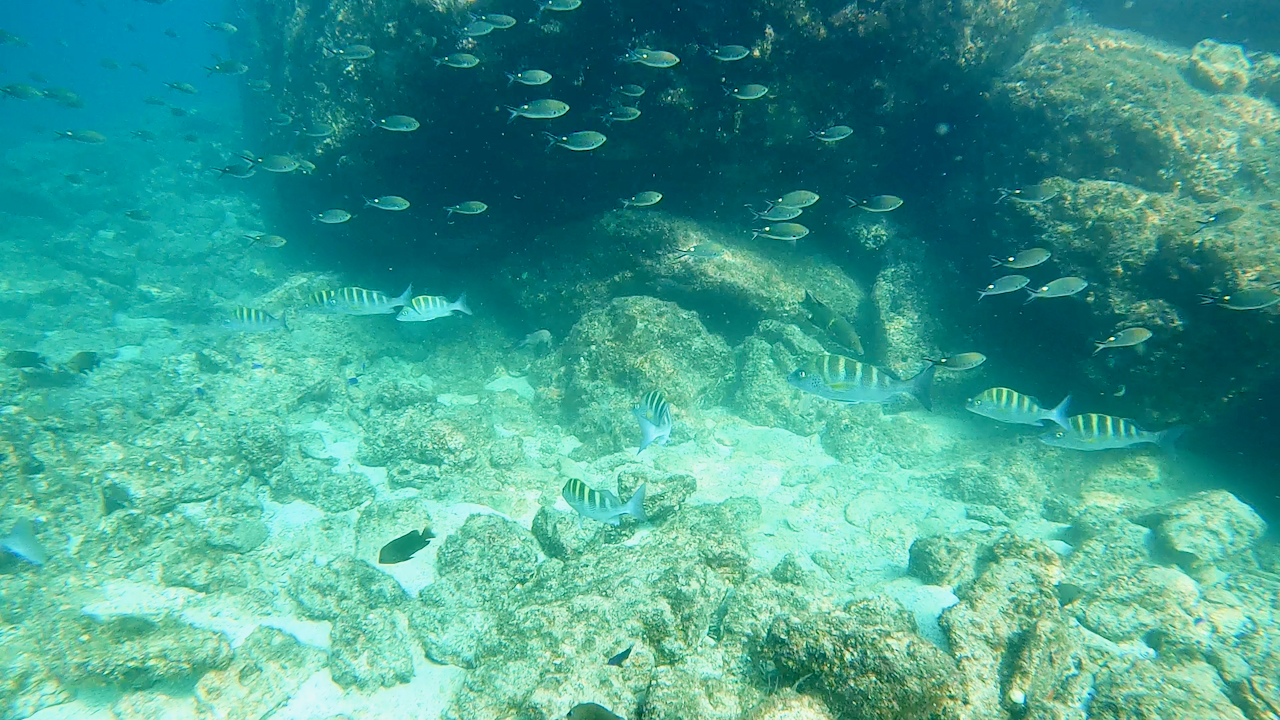
Bahia Coyote is about five miles across and is dotted with small islands and beaches. It lies within Bahia Concepcion, so the waters are doubly protected, and often quite a bit warmer than in the main gulf. If there is a drawback, it’s that the transpeninsular highway runs along the shore. While this provides access to the beaches for campers, it also brings the sound of trucks grinding up and down the grades all day and night. In contrast to the quiet park islands, there are campgrounds, restaurants and bars on the beaches. But they are relatively low-key and not too loud. We spent a couple of days there. For one thing, I wanted to revisit the dive site near Angel Rock (my name). Last year, I had a great dive there, but the camera battery died! I failed to get photos of octopi mating and friendly angelfish.
The outer edge of “Angel Rock” is a vertical wall of volcanic tuff about 35-40 feet deep. Along the bottom, there are a series of shallow caves – just like we see nearby on land. Well unfortunately during this visit the water was pretty murky. Didn’t see any octopi, but I couldn’t see very far into the caves until I swam in – giving any shy critters plenty of time to hide. But the friendly angelfish were still here. Specifically, the Cortez Angelfish. The Kings were not so cuddly. Once they spot a diver, they swim along with you, hoping to share in anything you’re hunting, I guess. They’re a little difficult to photograph because they keep getting too close to the camera. I can’t help wondering if someone has been feeding them. Panga operators do appear to shuttle tourists from the beach to snorkel or fish on the adjacent shallow reef.
Anyhow, I wanted to get to La Paz around Christmas time, so after a day or so, I raised anchor and set off to the south. As we rounded Punta Concepcion, one of those big aluminum expedition yachts pulled out of the anchorage and turned to follow. Well, as you know, any two sailboats headed in the same direction constitute “a race.” So It Was On. As the wind filled in, the bigger boat hugged the shoreline and hoisted a spinnaker, sailing dead downwind. We instead cracked off to more of a reach and went offshore to round Isla San Ildefonso. Somehow, at the end of the day, both boats came back together and entered Caleta San Juanico at the same time.
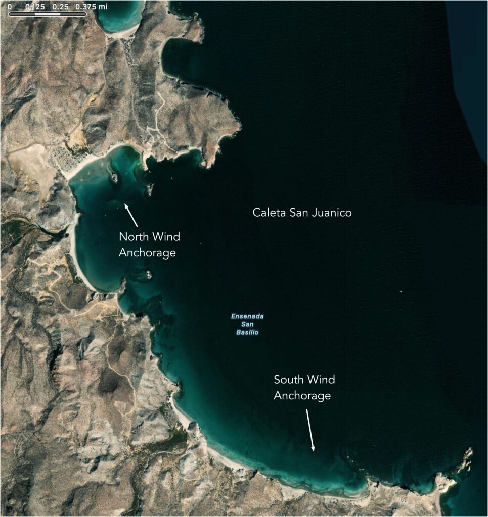
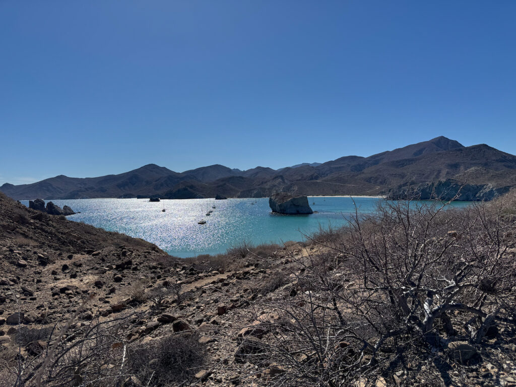
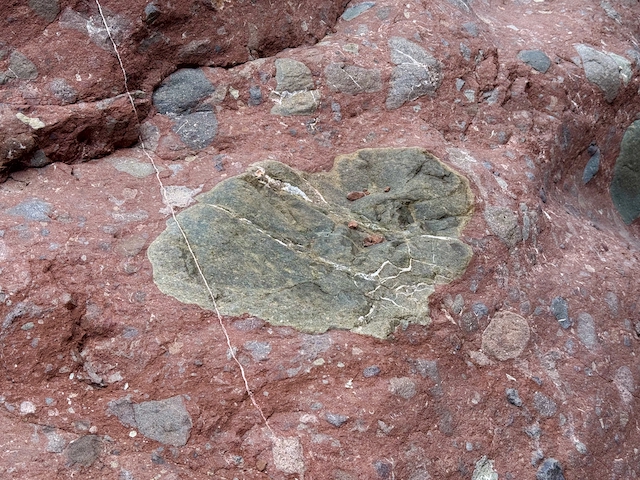
The last time I was in Juanico, I had the place pretty much to myself. But it was rather crowded this time around. I went for a few short hikes around the bay. The geology here is kind of twisted. Volcanic rocks intruding through sedimentary. Maybe more than one go-round, but that exceeds my ability to determine. There are fossiliferous sandstones, lava tubes, obsidian globules, carbonates tracing ancient hydrothermal systems. All mixed up together. Bizarre textures that I can only wonder about. On my last visit, the bay was full of large sting rays, and one had to be careful when approaching the beach. But I only saw a few this time. There are sea caves and small islands to explore by kayak. Some of the outlying rocks might make good dive sites, but the swell has been a little strong when I’ve been here. I walked across to the little cove just half a mile north of the bay and it looked like it might be a nice snug south-wind anchorage, but it doesn’t seem to be mentioned in the guide books. The one recommended at the south end of the bay is pretty rolly and windy, I can tell you.
A potentially hazardous northerly storm was predicted in a few days, and I thought it would be a good idea to be in Puerto Escondido when it arrived. So we upped anchor and headed south, mostly motor-sailing as the winds were light and kind of fickle. I worked a few off-shore breezes in the morning and a few on-shore breezes in the afternoon, but mostly it was a lay around on the foredeck while Otto drives kind of day.
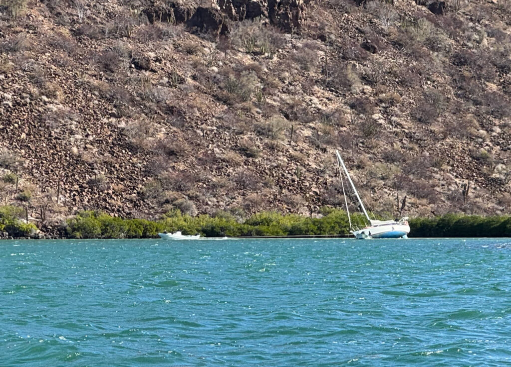
I was a little reluctant to check in to the marina any earlier than necessary, so we ducked in to “Honeymoon Cove” on Isla Danzante for a couple of days. There are several little coves on the northwest side of the island that a boat can tuck in to, depending on the wind direction. But it is so close to Loreto that it can be a little busy. Day-trippers and even kayakers come over from Puerto Escondido to spend the afternoon or the night. The shoreline is steep-to so one either anchors in deep water or uncomfortably close to the rocks. Or both. There are short marked hiking trails on the shore that even have interpretive signs to identify some of the vegetation.
The water was a little cool for swimming laps on this visit, but relatively clear. So I suited up and did some snorkling around the outer point. And a little kayaking to the outlying rocks.
But the storm was bearing down, so we made the short crossing over to Puerto Escondido and checked in to the anchorage. I figured a four-day stay on one of the mooring buoys would let the heavy weather blow past. But it turns out that four days costs the same as one week. About $180 US.
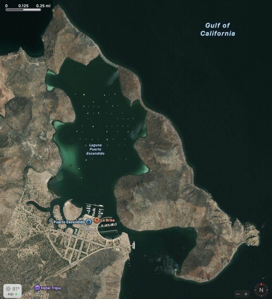
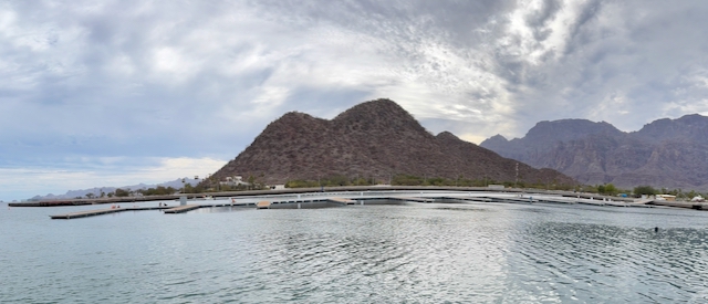
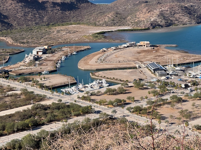
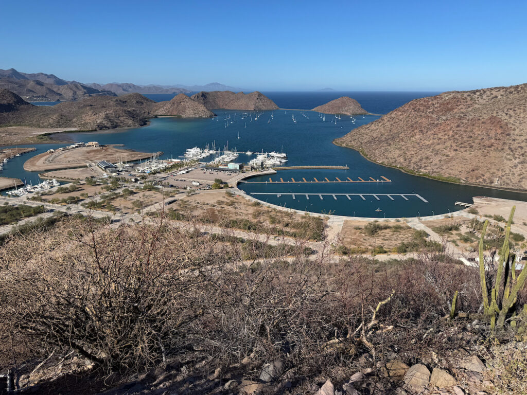
This was not s/v Wild’s first visit to Puerto Escondido, but it’s the first one making it in to this blog. The harbor is a natural hurricane hole, surrounded by a group of small volcanos and only open to the sea through a small channel at the southern end. A group of investors started to build a planned development back in the 1970’s, but after laying out the street grid, supplying water and power, digging canals, and building an elliptical marina, no housing was ever built. Remarkably, a team of maintenance workers keeps the streets and sidewalks in good repair, the street lights working, and the irrigated landscaping fresh and green. It’s an odd kind of a ghost town. I’m not sure why. I’m guessing it’s too expensive for people who might want to live there and those who could afford it don’t quite see the charms. And it has no sandy beach. There are big beach resorts (but with no harbors) a few miles north and south from here that maybe create an investment vacuum.
More recently, development has started up again. A very nice modern marina and a boat yard were built a few years ago. An array of mooring buoys were planted in the harbor. A deep water dock on the outer harbor accommodates cruise ships and super yachts. And on this visit, we saw signs of life in the old ellipse! New docks are under construction and a few luxurious homes with private docks are under construction in the canal district.
But Puerto Escondido is very expensive for the likes of shabby cruisers. The small tienda is loaded with gringo-bait items. (I even found a block of Tillamook Cheddar!) They will happily provision your boat with anything you want if you leave a detailed list. I can only imagine what that costs. (If you have to ask…) A small sack of stuff off the shelves will set you back as much as $70 US! More reasonably-priced groceries and other provisions can be had in Loreto, which is 30 km north. But the cheapest way to get there is a rental car that costs $70-$80 US a day. (For comparison a rental car in La Paz runs around $20.) Although the service is very convenient – just tell the marina office when you want the car and someone will meet you on the dock with the keys.
Well, the storm rolled in and while we have certainly seen worse, I stayed on board to keep an eye on things. Our only casualty was a SUP paddle that blew off the rack, some time in the night. One boat did break loose and go up on the beach, but crews managed to pull it off at the next high tide.
So I did rent a car and made a provisioning run to Loreto. Walked around the city center a bit before hitting the mercados. A power pole and some xmas decorations had blown down on the waterfront and it was still pretty breezy. Perpendicular to the shore, shops and cafes line the pleasant shady arcades. It was tempting to stop in for a margarita, but not when I’m driving a rental car. Back at PE, I took advantage of one of the few operating fuel docks in the Sea of Cortez and topped off the tanks. Still had a few days to kill.
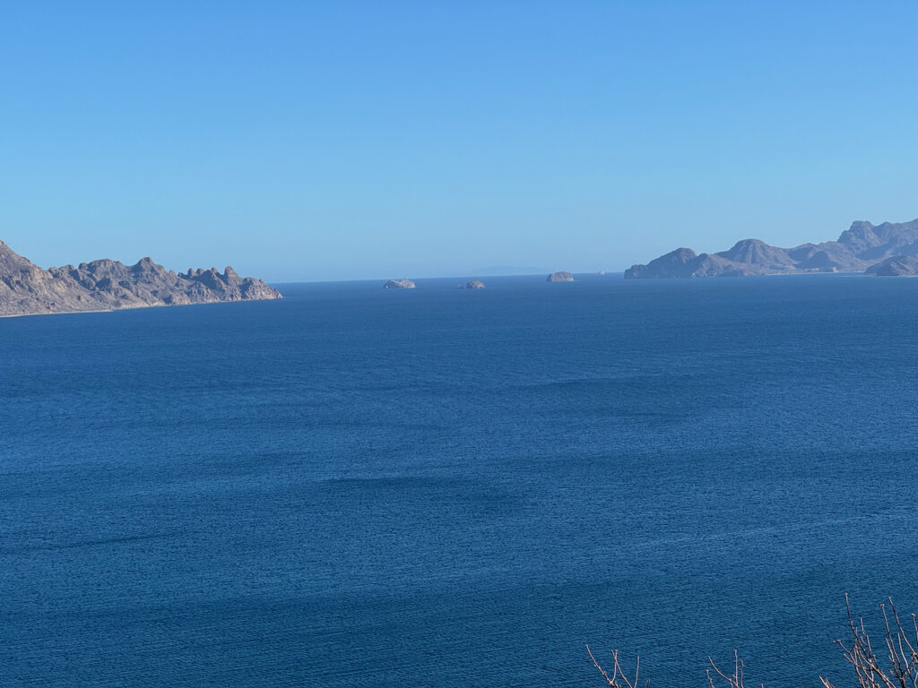
One thing that is free at Puerto Escondido is (are?) some pretty decent hiking trails. Just outside the street grid, a network of trails climbs over and around the volcanic hill that forms the west side of the harbor entrance. It’s easy to make a five mile loop around these, with great views of the harbor, the coastal plain, and the mountains looming above. Most of the year, this is best tackled in the cool of the morning, but in December, it was reasonable at any time of day. These trails also link to a beach, just outside the harbor. One may encounter a free-range burro or two along the way.
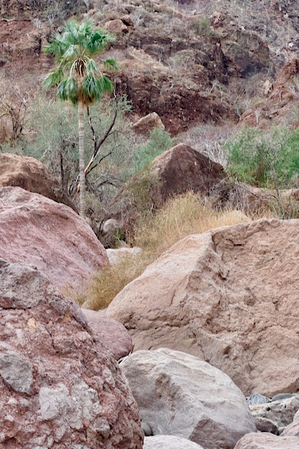
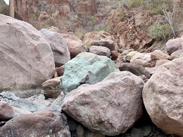
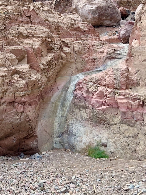
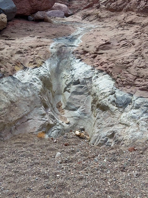
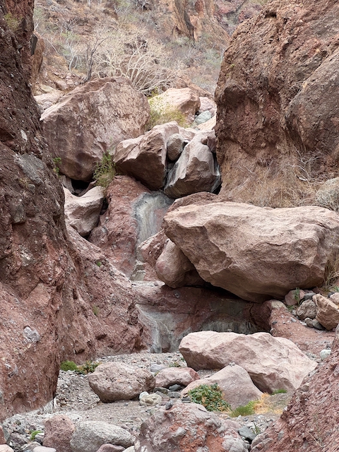
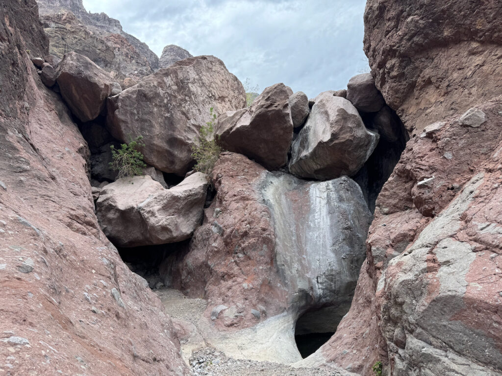
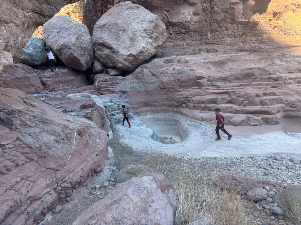
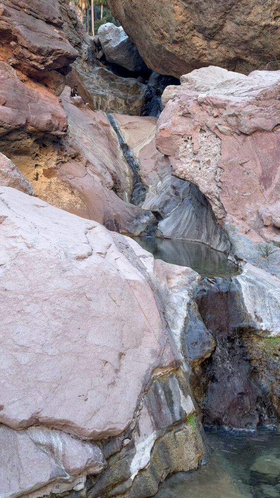
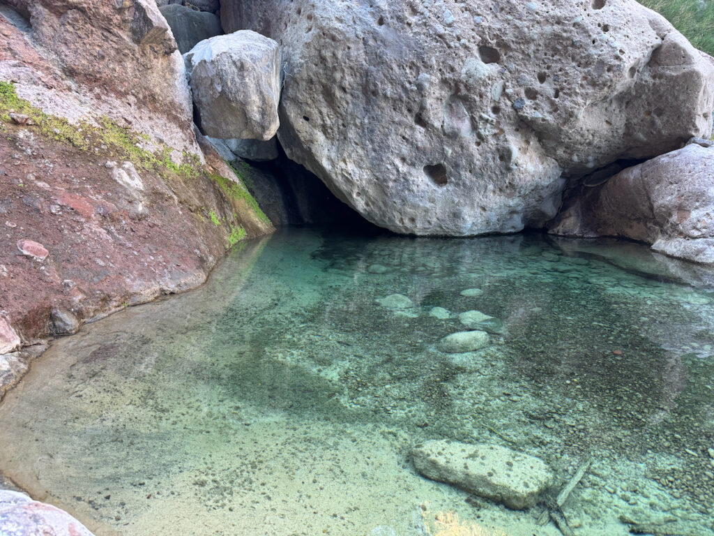
Any listing of things to do around Loreto will mention Tabor Canyon as a must-see attraction. And conveniently, the trail head is just across the highway from Puerto Escondido. (If you walk there and back, it adds about five miles to your hike. An easy walk across the coastal plain, past the electrical substation, the water plant, and the massive diversion dam that keeps flash-floods from overrunning the highway and the port. But you can drive or bike that part, if so equipped.) The canyon cuts into the volcanic tuff mountains of the Sierra Gigantica. The rocks are all fantastic shades of red and green and wonderful mixed-up breccias. Water flowing down from the mountains has carved amazing channels and pools into the relatively soft rock. These are a great draw for wildlife during the dry season, including several endemic species. Although it is sometimes called “a trail,” this is more of a “route” through, around, and over boulders ranging from car-sized to house-sized, and climbs up bare rock chutes and ledges. There are a few cairns left to suggest the best way through and occasional ropes or cables to aid at some of the more vertical stretches. Maybe more of a puzzle to solve combined with an extended jungle-gym workout than a simple hike. Great fun if you’re in to that sort of thing! I went up there on a couple of days. Never found the limit of how far you could go, before I ran out of daylight.
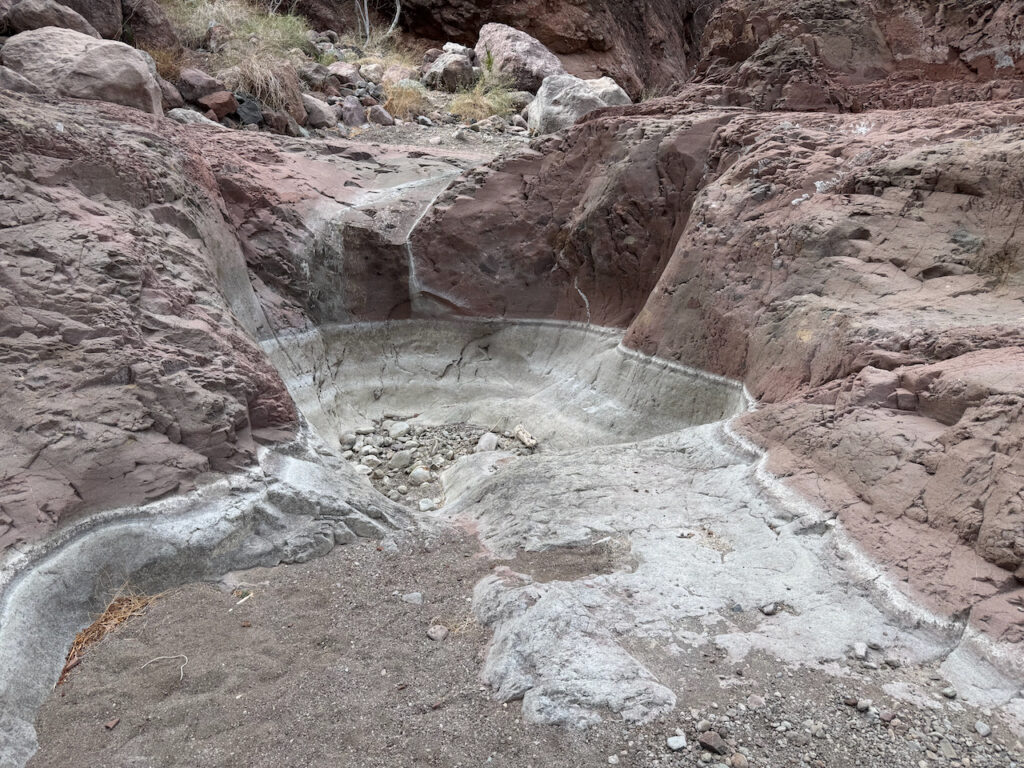
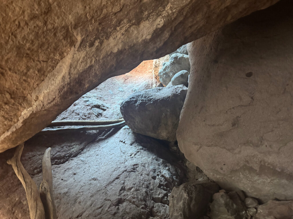
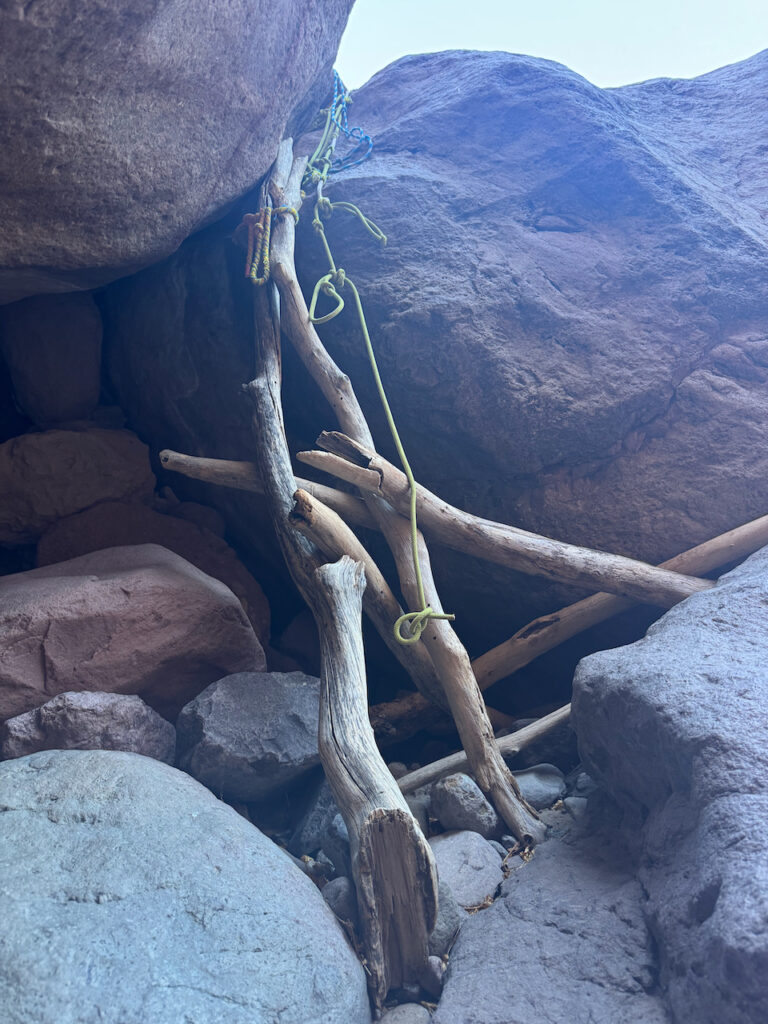
Until we come to this place, where there is no obvious way to continue, without special skills or equipment. But the secret is inside that little “cave” at the lower left.
Crawl inside to the back and look up to find a chute with a rope dangling to pull yourself up. Then scramble over to the right and find some more technical stuff to help haul yourself past the overhang. There are a few more spots like this farther up.
Farther up the canyon, there is more running water, more pools, and more vegetation.
Well, I have more, but in summary, it was a really good time. I arrived back at the boat at sunset, tired, dirty, a little bloody and sore. Showered off and baked a pizza with everything.