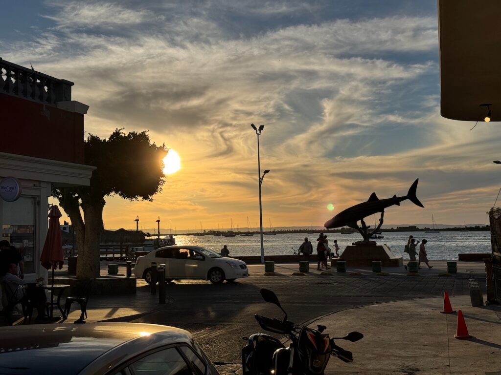
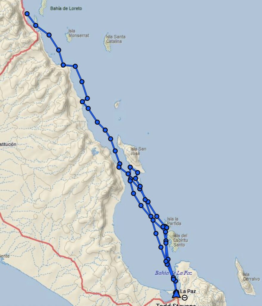
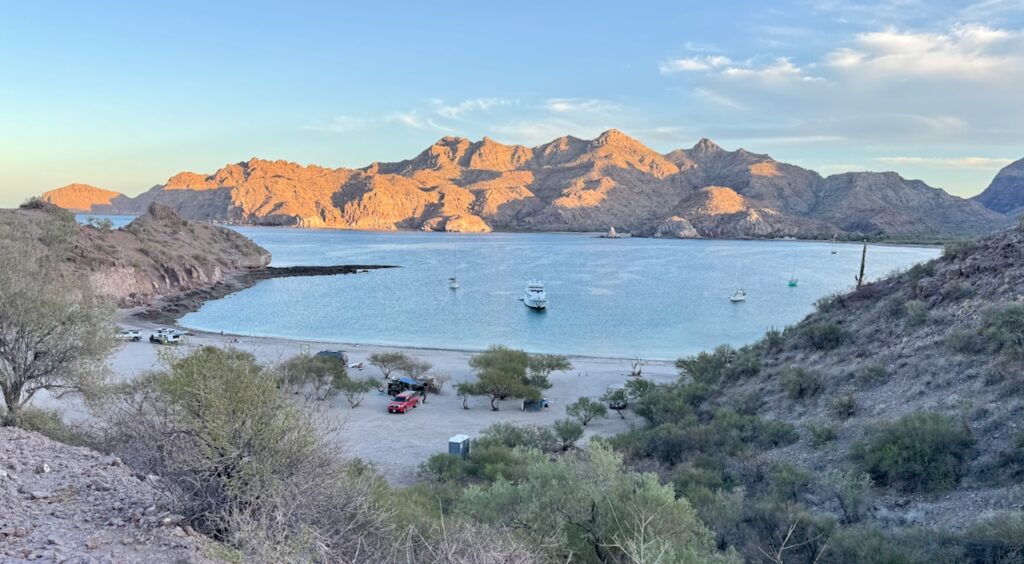
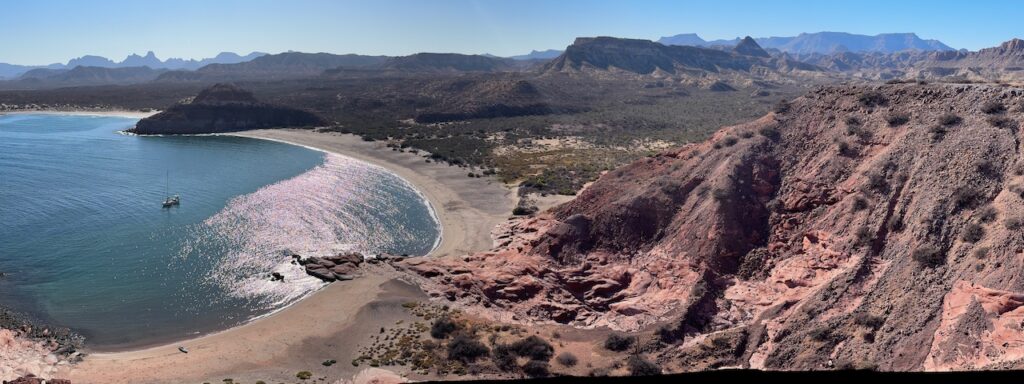
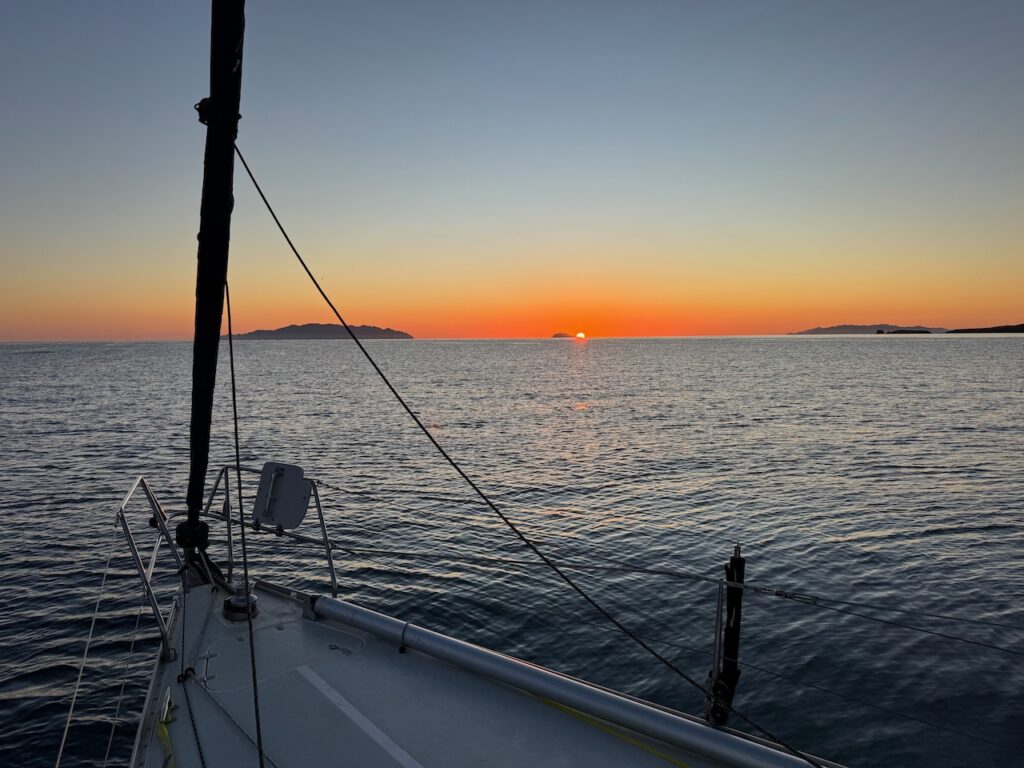
Continuing our recap, s/v Wild headed south on December 17 (still 2024). It was a bit slow sailing until we got out past “The Candlesticks” islands (in the distance in the pic above) but then we picked up a bit of off-shore breeze and scooted on down about 25 nautical miles to Agua Verde.
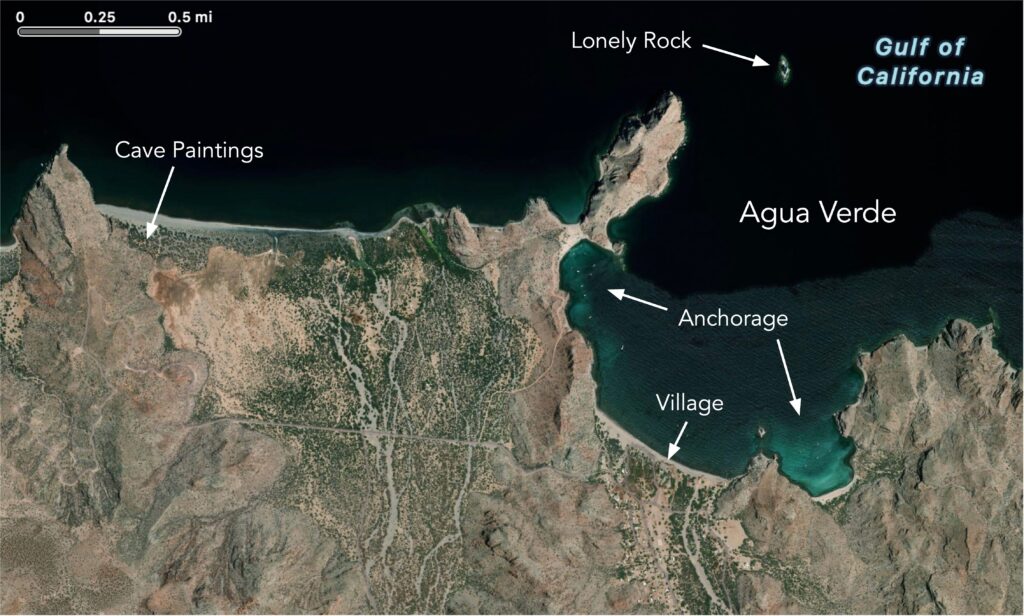
This is one of the more popular anchorages on the route. I suppose because you can dinghy in to the beach and have dinner and a beer at the beachfront cafe in the village. (But I never have.) You can anchor anywhere along the shore, but unless you can get tucked up into one of the two coves, it can be a very rolly and uncomfortable place. It all depends on how many boats got there before you and how considerate they are about sharing the anchorage. This time we were in luck and found a spot right up in the western cove, next to a large motor yacht. There is a little beach there where overlanders camp and fishermen launch pangas.
Unfortunately, one of the first things that I noticed was that the water was not very clear. On closer examination, I saw that a lot of the cloudiness was due to millions upon millions of tiny fish larvae, less than an inch long. Pelicans and seagulls seemed to have eaten their fill and sat contentedly on the rocks.
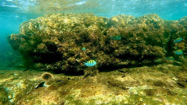
I went for a snorkle but the reef was relatively barren. Too close to all the tourists on the beach, I guess. I had a little better luck out at the far end of the reef, in the shallows.
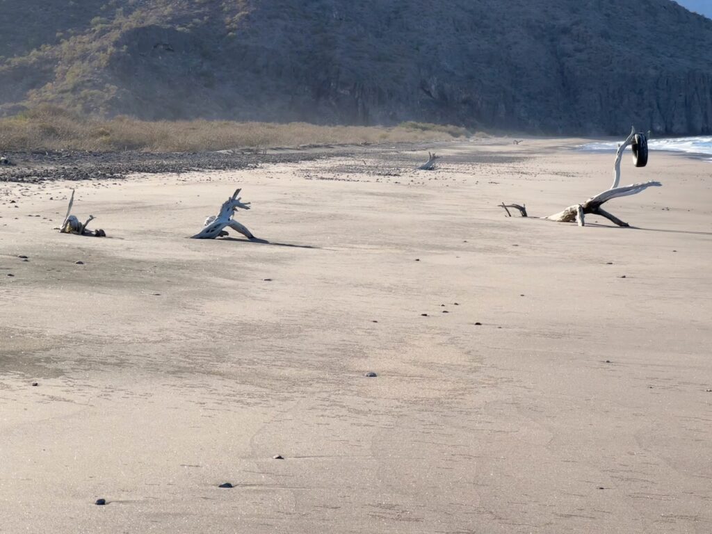
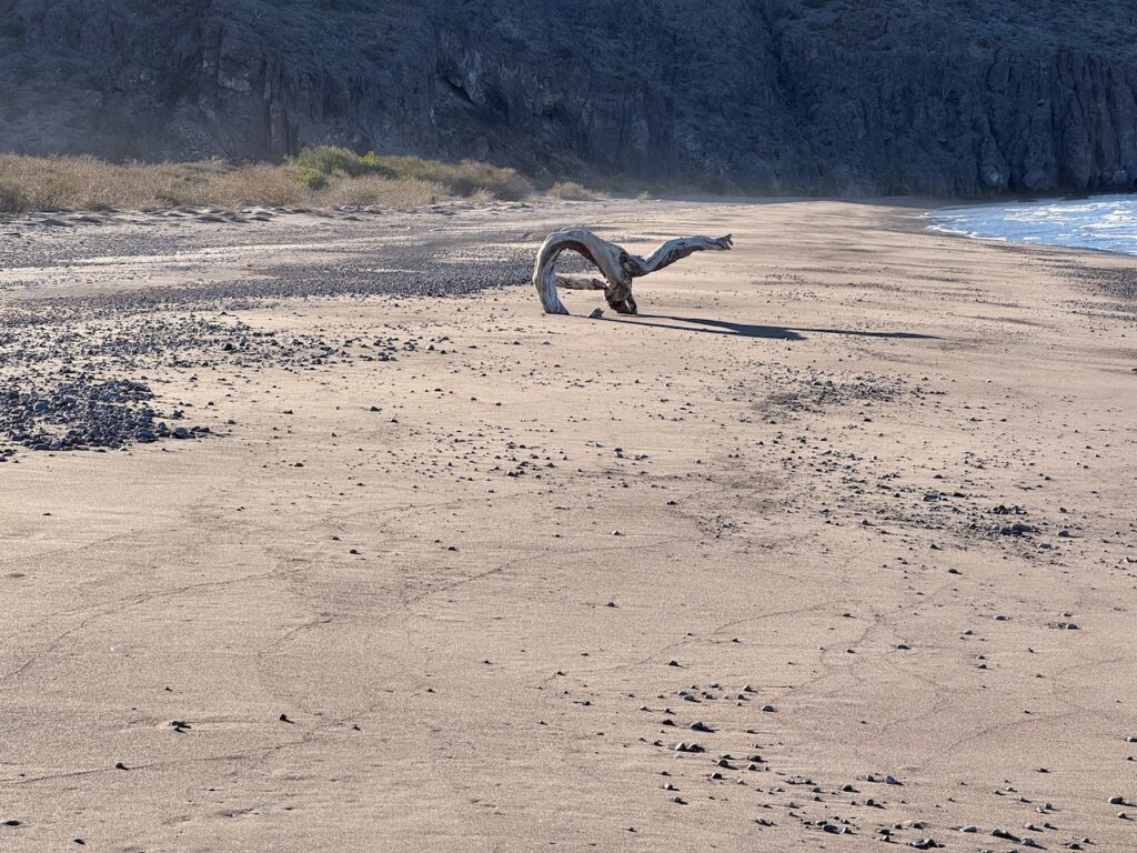
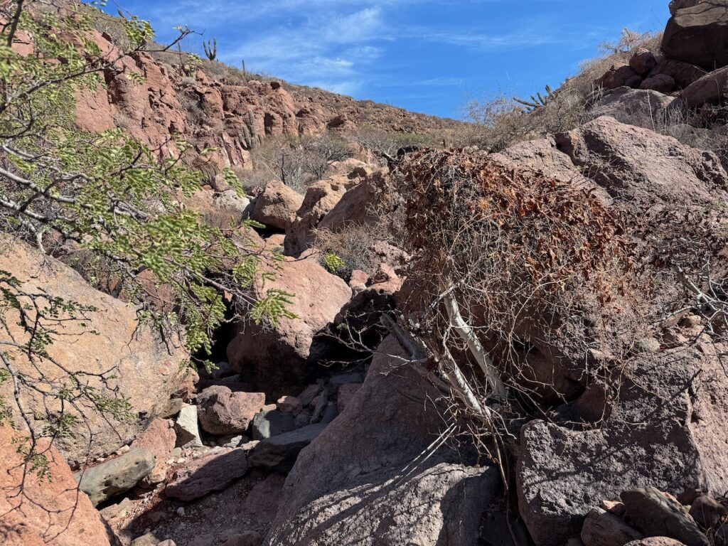
There are several hiking trails around and over the rocks. I found my way over to the next beach to the west, where distant silhouettes of driftwood appeared to show strange creatures cavorting in the sand.
Horsie and three doggies? Siri identifies the “horsie” as “a Humpback Whale,” or alternatively “a spiral jetty.” I think that Siri must do hard drugs.
An Anteater? Elephant? Siri says that it’s “a Great White Shark.” *sigh*
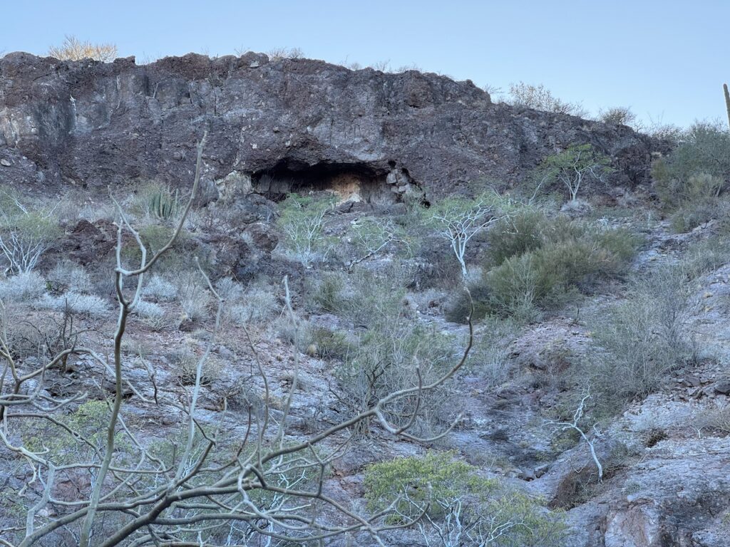
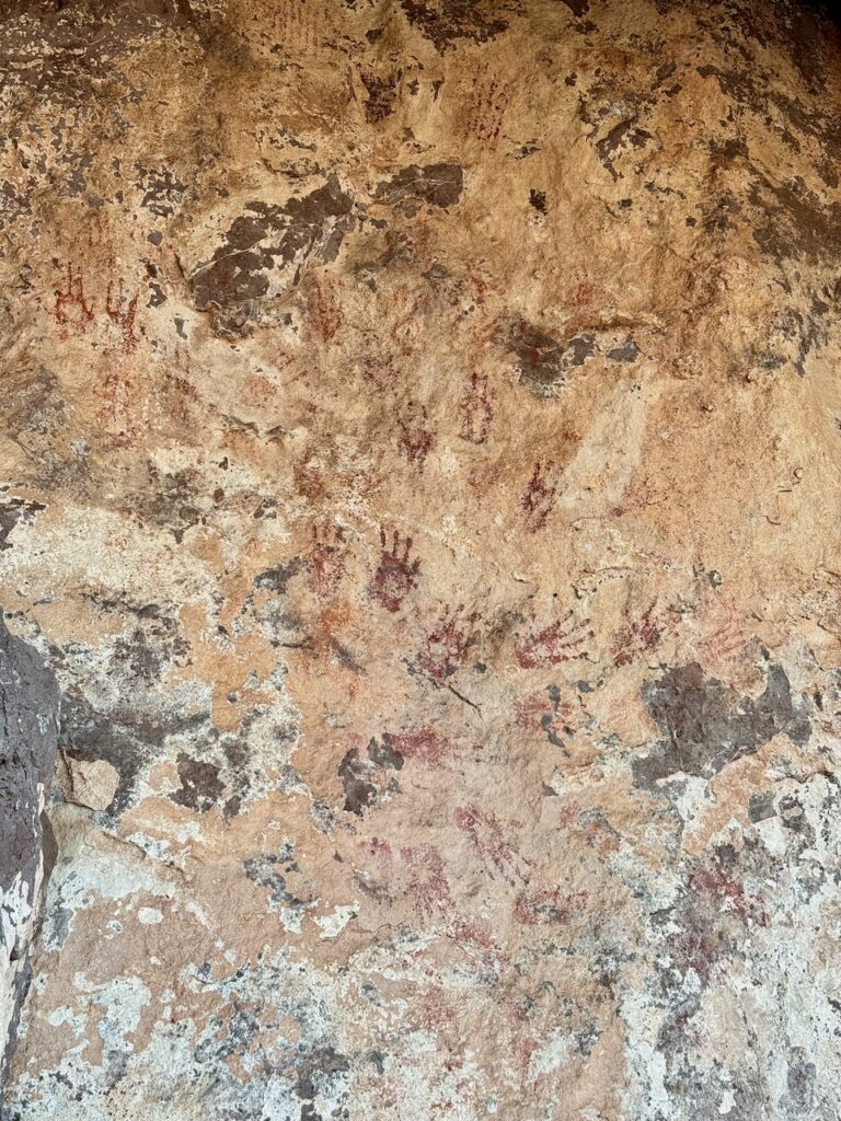
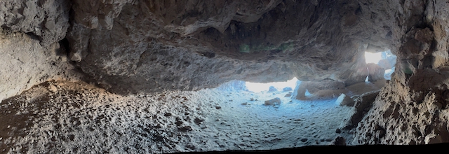
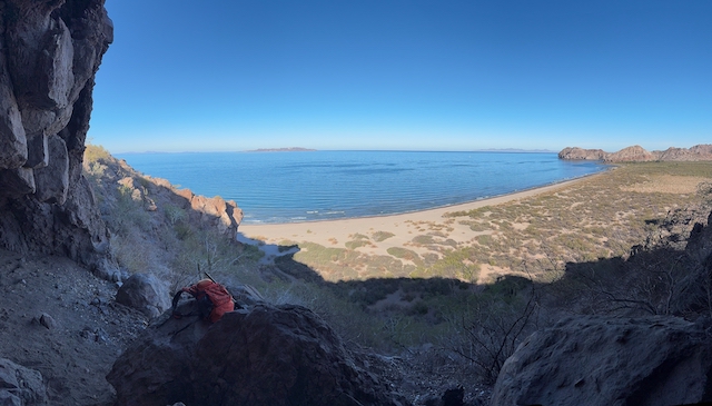
At the far end of the beach, if you look up at the cliffs, there is a cave just below the rimrock. Inside, you can find aboriginal artwork. There is a lot of it in Baja. Here, it’s just an array of red handprints on the white carbonate surface coat. What does it mean? Maybe “I was here!” And “Me too!” There is a commanding view of the beach from here, but no sign that the floor was ever leveled to make a habitation. Probably no drinking water conveniently near.
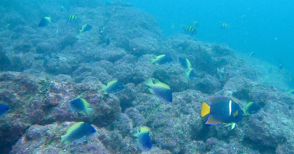
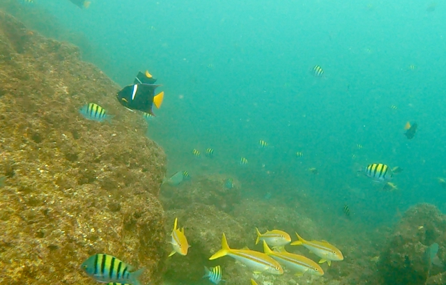
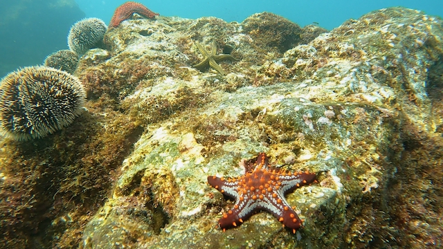
The next day, I went on a dinghy mission out to Roca Solitaire, which guards the entrance to the bay, and had a scuba dive along the east side of the rock. Here’s where all the fish are! There were dozens of King Angelfish, schools of Sergeant-Majors, Jacks and Chromises, and a few Damselfish. Different species of starfish and urchins were arrayed on the rock like an assortment of Christmas cookies. The water was still a little murky though. You could get below the murky layer, at about 50 feet, but then it was pretty dark. The cloudy stuff absorbed most of the light.
There was a fresh wind, so the next day we hopped another 20 nautical miles down to Puerto Los Gatos. This is another popular anchorage with striking red rock formations and three reefs to dive and snorkel on. (And to avoid when sailing in to the bay!) We made good time sailing, but the swells were rolling straight in to the bay. However I suspected that there might be room for one or two boats to tuck in behind the outer reef and find a relatively calm spot to anchor. And I was right! Had the place all to myself for a couple of days.
Well, except for this guy named Rodolfo from Timbabichi (A few miles farther south) who always shows up, sooner or later, in a beat-up panga. He usually has a few little fish or lobster (possibly illegal) to sell. If you don’t buy something, he resorts to begging. This time I gave him a couple of cans of beer and some zip-ties.
I don’t see from my notes that I went on any dives here on this stop. Or at least didn’t take any photos. I guess the water was a little choppy at the reefs. Just went on some hikes around the red rock formations.
Then caught another northwesterly wind on the 23rd and sailed another 30 nautical miles down to San Evaristo. This is a small fishing village on the peninsular side of the San Jose channel. There are usually a few cruisers anchored there. I don’t seem to have any photos filed away for that day, but I remember kayaking around the bay. One of the other boats in the anchorage looked familiar and it turned out to be s/v Aurora from back in Hood River. Recently arrived with the Baja HaHa rally. I stopped by and said hello.
But I needed to get on down to La Paz to refill some prescription medication. (And no, I’m not talking about restocking the beer. But… that too.) There was no fresh food left – or what was left was getting kind of moldy. So the next day we motor-sailed south through the flukey winds in the channel, plowing through sickly clouds of red tide and masses of jellyfish. Our destination was Isla Partida, another 28 nautical miles, and we anchored in Ensenada Grande. This is the northernmost part of the popular national park destination at Islas Espiritu Santo. You can usually expect to find a busy procession of pangas ferrying tourists on day-trips from La Paz. But they rarely go beyond the beach.
I think I only saw one group come in on Christmas Day. A panga came in the night before and a crew set up beach chairs and awnings and ice chests and tables, then went away. They left one teenager alone to guard the camp all night.
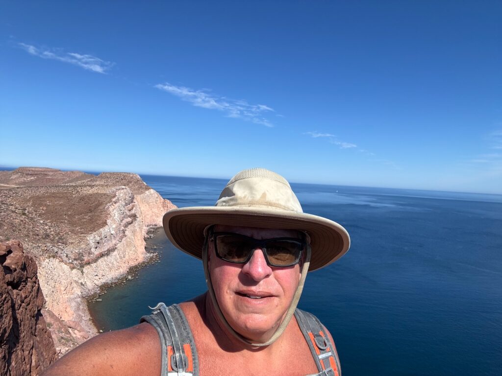
I spent the holiday hiking the short trail to the other side of the island and exploring a little way up the ridge line on either side. Well, it’s not so much a “trail” as a “route” up a boulder-filled arroyo. You hop from rock to rock until you get to the next cairn or marker. Good exercise but probably more fun if you have teenage knees. A lone sailboat could be seen working its way north, on the seaward side of the island. Just a white dot in this photo. Isla Cerralvo (AKA “Jaques Cousteau Island) loomed in the distance.
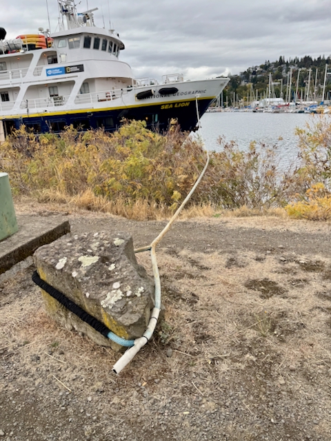
On the way back down to the anchorage, I had just stopped to, um, irrigate a cactus, when suddenly a bunch of people came up the trail, around a corner. I was astonished! There must have been at least fifty of them. Mostly young, and lugging really expensive-looking cameras. They were wrangled by a couple of uniformed guides wearing “National Geographic” insignia. Later, I learned that these kids paid upwards of $8000 for a week of cruising and photography lessons. About what it costs me for six months… Back at the beach, I was perplexed. There were no more boats in the anchorage. Where did all those people come from? Later in the day, several large Zodiacs came roaring in to the beach, to pick them up. There must have been a mother ship in another nearby anchorage. Probably the Sea Lion or the Sea Bird – the same ships that we see cruising the Columbia River in the spring and fall. They too come down here in the winter.
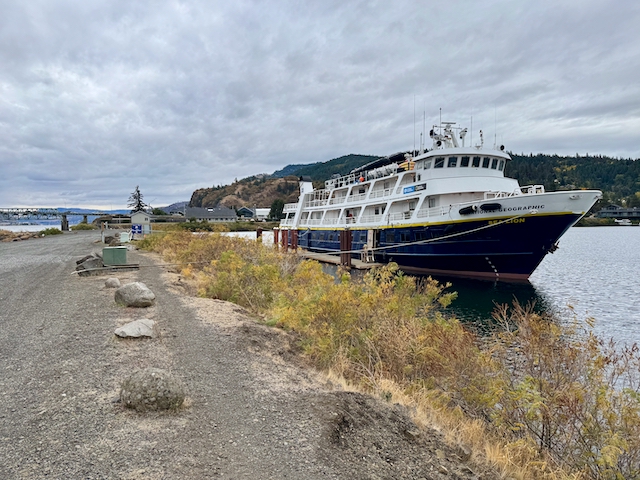
I’m not always sure about their mooring choices, however.
Back on board Wild, I baked a festive Holiday Pizza for Christmas dinner, and consumed the last of the beer.
The next day, there was a strong off-shore wind blowing all night. I hoped to ride it all the way in to La Paz. But when I woke up at dawn, the kayak was gone! I had tied it to the push-pit with a clove hitch, just like a thousand times before, but apparently it had worked loose and blown out to sea. I spent a couple of hours searching for it in all the nearby coves and beaches, but there was no sign. Now, I always knew that I’d have to part with it some day – it’s just too risky to head out into the Pacific with a large object like that hanging on the rail – but I thought I’d at least get a few bucks by selling it. (Yes, I made it all the way down the west coast with it, but that was mostly fair weather harbor-hopping.) Bit of a bummer, but in the end I had to hoist the sails and scoot on down about 20 nautical miles to the anchorage at La Paz. Bright lights, big city. New year.